
Efeimazerta Fm
Type Locality and Naming
References: Claret & Tempère, 1968; Beuf et al., 1971; Klitzsch et al., 1973; Fabre et al., 1983
Synonym: Equivalent(s): Klitzsch et al. (1973) suggest that it could be equivalent to the Akakus Fm of the Murzuq/Djado basin.
Lithology and Thickness
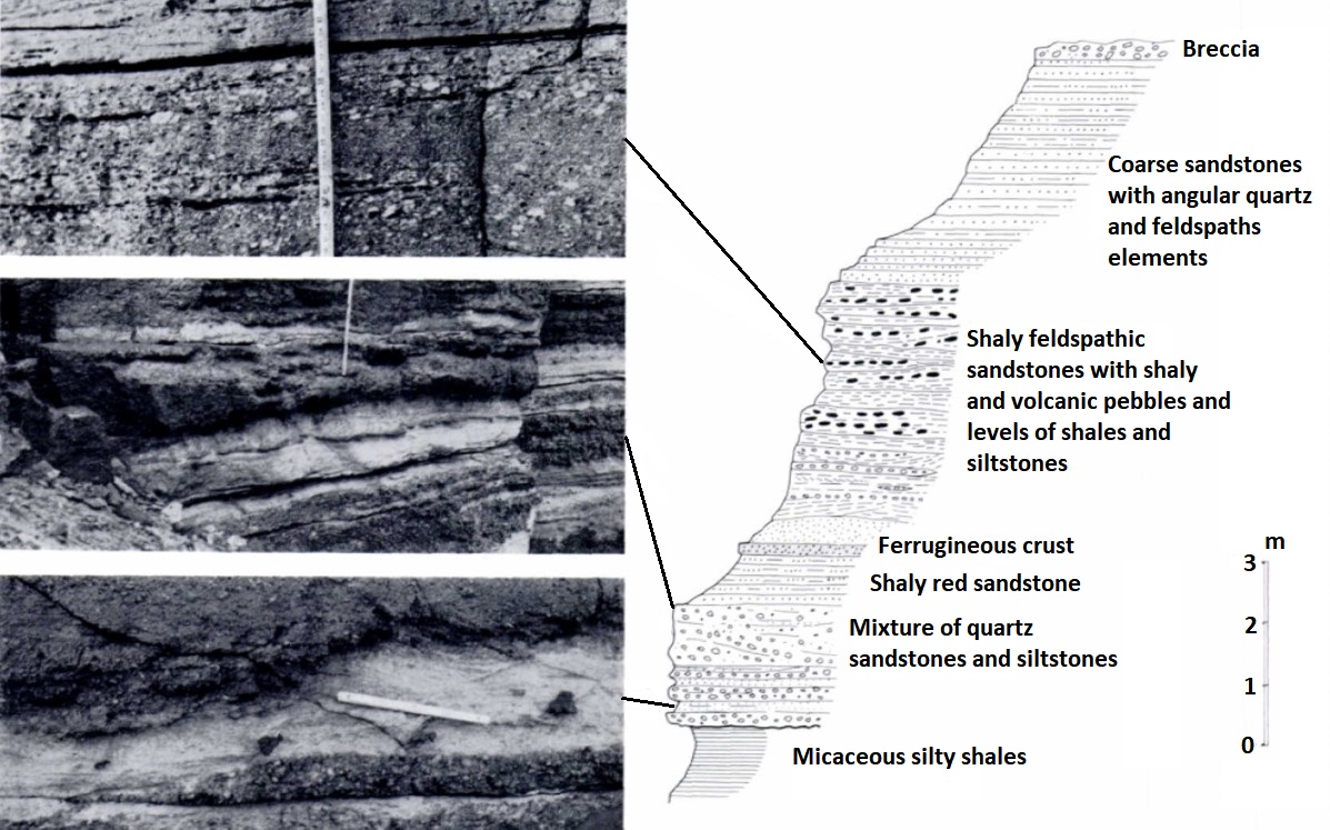
It is essentially characterized by the presence of detrital levels, conglomeratic (poudingue quartzitic, intraformational conglomerates of red, green, or gray clays, reworked, breccias) and very ferruginous horizons (Figure). Despite significant lateral variations, the proportion of clayey sediments generally remains preponderant in the formation, giving it a morphology reminiscent of the underlying Silurian shales (Graptolitic Shales). According to Beuf et al. (1971), it could represent the correlative deposits of an erosion surface. Dolerite sills or flows are associated on the edge of the Adrar des Iforas and the Aïr; sometimes, levels of feldspathic sandstone or sandy shales are interstratified. Thickness is 15 m maximum.
[Fig. 1. Section of the Efeimazerta Fm north of Aïr (Source: Modified from Beuf et al., 1971, p. 112).]
Relationships and Distribution
Lower contact
Transgressive on Graptolitic Shales Fm (near In Azaoua), Ordovician (Lower Sandstone) and the basement.
Upper contact
Overlying unit is the Anou Izileg Fm
Regional extent
Described by the Algero-Malian-Nigerien borders (Tassilis Ouan Ahaggar, Tamesna Sub-Basin)
GeoJSON
Fossils
Age
Depositional setting
Fluvio-Marine
Additional Information